The Official Tourist Board For Mercia  SHROPSHIRE |
|
|
|
|
|
|
| Welcome to Mercia. Press Control+B to Bookmark this site for later reference. | |
|
|
  Our List of Attractions in
Shropshire is, like our other pages on Mercia, a compilation of the
various sites in this area of what was once the Ancient kingdom of
Mercia. Whilst in the other Norman Counties we have found the local
sites and County Councils both friendly and co-operative we have
recently been attacked by a local site for using their alleged
descriptions and pictures of the Norman County of Shropshire. We, on
the other hand, feel that the more the area is promoted the more
tourists will come and the people of Shropshire will prosper. we will
continue to show the attractions. We shall shortly be publishing
the correspondence from that body and our responses. In fact
other County Councils contact us on a regular basis to ask for us
to include announcements & change. This list is nothing but a
convenient visual search engine so that visitors can find where to go
and what to do. It is not "War &
Peace" or some other masterpiece. We trust that the local
councillors, MPs, Journalists , Attraction Owners and other influential
people in the area we are approaching will understand that we are
trying to help not hinder and have so far stretched out to 380 million
plus page visitors. We are happy to have brought many tourists and
visitors to the area and will continue to do so. We also thank
Wikipedia, the free encyclopedia for all their assistance.“Floreat
Salopia” Our List of Attractions in
Shropshire is, like our other pages on Mercia, a compilation of the
various sites in this area of what was once the Ancient kingdom of
Mercia. Whilst in the other Norman Counties we have found the local
sites and County Councils both friendly and co-operative we have
recently been attacked by a local site for using their alleged
descriptions and pictures of the Norman County of Shropshire. We, on
the other hand, feel that the more the area is promoted the more
tourists will come and the people of Shropshire will prosper. we will
continue to show the attractions. We shall shortly be publishing
the correspondence from that body and our responses. In fact
other County Councils contact us on a regular basis to ask for us
to include announcements & change. This list is nothing but a
convenient visual search engine so that visitors can find where to go
and what to do. It is not "War &
Peace" or some other masterpiece. We trust that the local
councillors, MPs, Journalists , Attraction Owners and other influential
people in the area we are approaching will understand that we are
trying to help not hinder and have so far stretched out to 380 million
plus page visitors. We are happy to have brought many tourists and
visitors to the area and will continue to do so. We also thank
Wikipedia, the free encyclopedia for all their assistance.“Floreat
Salopia” |
|||||||||||||||||||||||


|
|||||||||||||||||||||||

|
 Details |
|
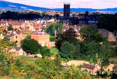
Bridgnorth
|
The Library,
Listley Street,
Bridgnorth,
WV16 4AW Tel: 01746 763257 Fax: 01746 766625 E-mail: info@bridgnorthshropshire.com |
| Church Stretton |
County Branch
Library, Church
Street,
Church Stretton, SY6 6DG Tel: 01694 723133 Fax: 01694 723045 E-mail: churchstretton.tourism@shropshire-cc.gov.uk |
| Ellesmere |
The Mereside,
Ellesmere, SY12
0HD Tel: 01691 622981 Fax: 01691 622981 E-mail: ellesmere.tourism@shropshire-cc.gov.uk |
| Ironbridge |
The Wharfage, Ironbridge
Telford,
TF8 7AW Tel: 01952 432166 Fax: 01952 432204 E-mail: tic@ironbridge.org.uk |
| Ludlow |
Castle Street, Ludlow, SY8 1AS Tel: 01584 875053 Fax: 01584 877931 E-mail: ludlow.tourism@shropshire-cc.gov.uk |
| Market Drayton |
49 Cheshire Street, Market
Drayton,
TF9 1PH. Tel: 01630 6512139 Fax: 01630 652139 Email: marketdrayton.tourism@shropshire-cc.gov.uk |
| Much Wenlock |
The Museum, High Street, Much
Wenlock,
TF13 6HR Tel: 01952 727679 Fax: 01952 727679 E-mail: muchwenlock.tourism@shropshire-cc.gov.uk |
| Oswestry Town |
Heritage Centre, 2 Church
Terrace,
Oswestry, SY11 2TE Tel: 01691 662753 Fax: 01691 65811 E-mail: ot@oswestry-welshborders.org.uk |
| Oswestry Mile End |
Mile End, Oswestry, SY11 4JA Tel: 01691 662488 Fax: 01691 662883 E-mail: oswestry.tourism@oswestry-bc.gov.uk |
| Shrewsbury |
The Music Hall, The Square,
Shrewsbury,
SY1 1LH Tel: 01743 281200 Fax: 01743 218213 E-mail: tic@shrewsburytourism.co.uk |
| Telford |
The Telford Shopping Centre,
Telford,
TF3 4BX Tel: 01952 230032 Fax: 01952 291723 E-mail: info@telfordshopping.co.uk |
| Whitchurch |
12 St Mary's Street,
Whitchurch,
SY13 1QY Tel: 01948 664577 Fax: 01948 665432 E-mail: whitchurch.heritage@ukonline.co.uk |
 |
 |
| Shropshire
(including
Telford and Wrekin) has 22 settlements which are officially
towns. Many of them are very small (such as Clun and Cleobury Mortimer)
and there are many villages in the county, such as Bayston Hill and
Albrighton, that are larger than the smaller of these towns. Out of the
22 towns, 6 are in Telford and Wrekin, of which all but Newport now
make up the Telford new town. The five main towns of Shropshire are (in
order of size) - Telford, Shrewsbury, Oswestry, Bridgnorth and Newport,
though Ludlow is also considered a main town. Great British Heritage Pass - Visit Britain with the Great British Heritage Pass - the best of British sightseeing and historic Britain for UK visitors. Get free entry to almost 600 British heritage tourist attractions around England, Scotland, Wales and Northern Ireland. |
|||
SHROPSHIRE ATTRACTIONS |
Shropshire
County
Council |
communications
@shropshire.gov.uk Shropshire Council websiteA |
Tel/Fax |
| We would
like to thank the following for their contributiod to this list: |
107.4
Telford FM Shropshire Star Building, Waterloo Road, Ketley, Telford. TF1 5HU. |
107.1
Oswestry FM 14 Salop Road, Oswestry, SY11 2NU |
|
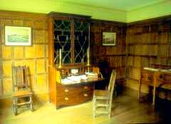
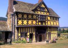
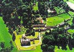
| Acton
Burnell Castle The castle of Acton Burnell is
located
in a remote village of the same name and isn’t a traditional castle at
all.
It is one of several fortified manor houses located in Shropshire that
would
have been built for comfort, rather than battle,The building was
believed
to have started in 1283 as a replacement for the original building,
home of
the Burnell family. The head of the family, Robert Burnell, was the
Chancellor
of England and a personal friend of King Edward I.Acton
Burnell
|
 |
Acton
Burnell Shrewsbury Shropshire ACTON BURNELL CLICK |
Tel: 0871 716 1942 |
Acton Scott Historic Working Farm MuseumThis museum is dedicated to telling the story of the working man in this area of the country, and how lives of ordinary people have changed through history. Filled with interesting pieces of documentation, artefacts and pictures, the museum offers a fascinating social history, which is quite different from the classic top down history that you often receive. |
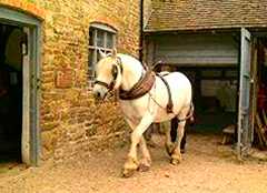 |
Wenlock
Lodge, Acton Scott, Church Stretton Shropshire SY6 6QN Map ACTON SCOTT CLICK |
Tel
01694 781306/7 Fax: 01694 781569 |
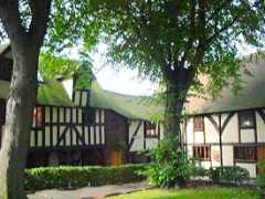
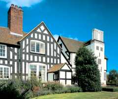
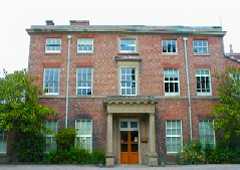
| Adcote
House Adcote is a Grade I
listed building designed by Norman Shaw and built
to a Tudor design in 1879. Its features include a Great Hall,
Minstrels' gallery, William De Morgan tiled fireplaces and stained
glass windows. Landscaped gardens include many fine trees. It is now a
girls' boarding and day school.
|
 |
Little Ness Shrewsbury Shropshire SY4 2JY ADCOTE HOUSE SCHOOL CLICK |
Tel: +44 (0)1939 260202 Fax: +44 (0)1939 261 300 |
| Angel
Gardens, Springfield Angel Gardens are situated at 1000
feet and have panoramic views of the stunning Shropshire countryside
and Welsh ranges. They nestle in the lee of Titterstone Clee Hill
one of the highest Shropshire hills. The views can be appreciated
from a six sided gazebo. There is a large lake spanned by a Willow
Pattern bridge and surrounded by myriads of plants including hostas,
day lilies and crocosmias. A smaller pool lies between the Italian
Rosette garden and a contemplative Chinese Swing.A sheltered cottage garden is
surrounded by stone walls and hosts exotica including trachcarpus.
There are colourful rockeries and a fernery with lych gate. There is a children's cottage and
Pavilion Tea Rooms serving teas and lunches.
|
 |
Springfield Angel Lane Bitterley Ludlow Shropshire SY8 3HZ ANGEL GARDENS CLICK |
Tel: +44
(0) 1584 890381 Fax: +44 (0) 1584 890381 |
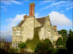
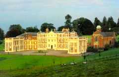
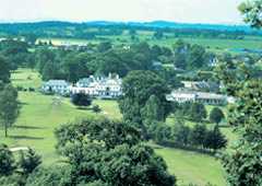
| Attingham
Park Attingham Park was the
ancestral
home of the Berwick family for over 160 years. Each generation
has left its unique mark on the house which vividly recalls the England
of Jane Austen. This huge mansion is set in a
magnificent
deer park, artfully landscaped by the great Humphrey Repton.Visit
the
newly restored
icehouse
and greenhouses and see restoration in action as work continues on the
Nash
Staircase and Lady Berwick's sitting room. Visitors
enjoy
the
magnificent
Regency interiors that were created to reflect the delicate
elegance
of the time. The collections include ambassadorial silver,
Italian
furniture and Grand Tour paintings collected by the 3rd Lord Berwick.Costumed
guides
bring
Attingham's
colourful history to life including the story of the most corrupt
election
in the history of politics. There are guided tours from 12noon
(booking
essential, on the day of your visit, please ask at reception).The
house
offers a fascinating
insight
in to life above and below stairs and visitors are fascinated by the
kitchens,
tenants parlour and servants hall.Visitors can enjoy a
number
of woodland walks along the river Tern and through the Deer Park,
taking in
the picturesque views of the Wrekin and Shropshire Hills. Walks
range
from one mile to three miles. Opening hours for
2007: House3rd
- 25th March: 1pm - 4pm Saturday and Sunday 26th
March
- 30th October: 1pm
-
5.30pm Monday, Tuesday, Friday, Saturday and Sunday
|
 |
Shrewsbury Shropshire SY4 4TN Attingham Park is located 4 miles SE of Shrewsbury in Atcham on the B4380. Turn into the estate via the entrance opposite the Mytton & Mermaid Hotel. Email:- attingham.park@nationaltrust.org.uk www.nationaltrust.org.uk |
Tel: +44
(0)1743 708 123 Fax: +44 (0)1743 708 175 |
| Bear
Steps Hall A set of medieval
buildings restored by Shrewsbury Civic Society with varying
exhibitions.
|
 |
St
Alkmond's Square Shrewsbury Shropshire SY1 1UH | |
Tel: +44
(0) 1743 356511 Fax: +44 (0) 1743 344994 |
| Benthall
Hall is a 16th
century English country house located close to the town of Broseley,
Shropshire, England, and a few miles from the historic Ironbridge
Gorge. It retains much of its fine oak interior, and an elaborate 17th
century staircase. It is still occupied by the Benthall family, but has
been owned by the National Trust since 1958, and is open to the public
two to three afternoons a week during the summer season
(March-September).The Hall was built around 1580, probably on the site
of an earlier 12th century medieval manor and manor house. During the
Civil War it was garrisoned, and was a site of several skirmishes.
|
 |
Broseley Shropshire TF12 5RX BENTHALL CLICK |
Tel: +44
(0) 1952 882159 |
| Bishop's
Castle Bishop's Castle is a small market
town in Shropshire, England, and formerly its smallest borough.
According to the 2001 census it had a population of 1,630. Bishop's
Castle is one and a half miles east of the Welsh border, about twenty
miles north-west of Ludlow and about twenty miles south-west of
Shrewsbury. To the south is Clun and to the east is Church Stretton.
The town is best known as a thriving market town with a strong
agricultural community and has more recently become known for its
alternative community including artists, musicians, writers and
craftspeople. This is excellent walking country and Bishop's Castle is
a "Walkers are Welcome Town", gaining the award this year( 2008). The
long distance path The Shropshire Way runs through the town and Offa's
Dyke is only a few miles away to the west. The ancient Kerry Ridgeway,
a pre-bronze age route, runs from the town. The BC Ring, a 60 mile
challenging route around the town, was published this year (2008). The
town has two breweries, many pubs and eating places and a wide variety
of places to stay in the town itself and the surrounding countryside.
|
 |
Tourist Information Point Located at Old Time, High Street.
|
|
| Bitterley
Court 'Bitterley''' is a village and civil parish in the South Shropshire district of Shropshire, England. According to the 2001 census it had a population of 802. The village is about four miles east of Ludlow. Bitterley is the location for Bitterley Court, the longtime seat of the Walcott family, who had previously sold their Walcot Hall to Robert Clive, 1st Baron Clive, known as Lord Clive of India. |
 |
Ludlow Shropshire SY8 3HL BITTERLEY COURT CLICK |
Tel: +44
(0) 1584 890265 Fax: +44 (0) 1584 891414 |
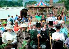
| Blists
Hill -Victorian
Town This interesting exhibition
comprises one of
the largest open air museums in the entire United Kingdom. Created in
over thirty acres of woodland and open land, the town is a recreation
of a village from Victorian times. There are all of the major amenities
that one would expect to see in a community and as a visitor you can
really step back in time and see how people in this area might have
lived in the past.
|
 |
Exit J4
of M54. Follow signs
for
Ironbridge Gorge. Then follow signs for Blists Hill Museums BLISTS HILL VICTORIAN TOWN CLICK |
Tel:
01952 884391 |
|
Boscobel House
&
The Royal Oak Let the romance of Boscobel
flow
over you. This modest but beautiful timber-framed hunting lodge
sheltered Charles II after his defeat at the Battle of Worcester in
1651. He evaded capture by sheltering in a nearby Oak tree, which soon
became known as the 'Royal Oak'. He then escaped to France, later
returning to restore the monarchy
to England in the 1660's.Explore this fully refurbished
house
and gardens. Visit the dairy, farmyard and smithy. Hear
tales of the 'Priest
Holes'
on your guided tour and afterwards relax in the tea room. A visit is
not complete without seeing the descendant of the original 'Royal Oak',
badly damaged in
recent storms, but still standing as a reminder of dramatic events over
350
years ago!Whilst in the area, you can
also
visit White Ladies Priory, the remains of a nunnery once part of White
Ladies House. It was in this house that Charles initially took refuge
after his defeat.
|
 |
Brewood,
Bishops
Wood, Shropshire ST19 9AR Located on a minor road from A41 to A5. 8 miles North West of Wolverhampton. 5 minutes drive from M54 junction 3. BOSCOBEL CLICK |
Tel:-01902 850244 |
|
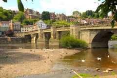
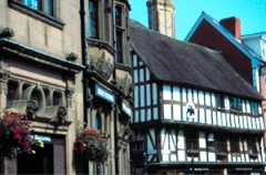
Bridgnorth Bridgnorth is a town in Shropshire,
England, along the Severn Valley. It is split into Low Town and High
Town, named on account of their elevations relative to the River
Severn, which separates the upper town on the right bank from the lower
on the left. It is the seat and most populous town of Bridgnorth
district. The population of the town of Bridgnorth was 11,891 at the
2001 Census and a 2008 estimate puts it at 12,216. Bridgnorth is named
after a bridge over the River Severn, that was built further north than
an earlier bridge at Quatford. The earliest historical reference to the
town is in 895, at which time it is recorded that the Danes created a
camp at Cwatbridge, and subsequently in 912, Æthelfleda
constructed a mound on the west bank of the River Severn, or possibly
on the site of Bridgnorth Castle, as part of an offensive against the
Danes. In 2005, unverified German papers dating from 1941 were found,
outlining new details about Operation Sealion, the military plans of
Nazi Germany for an invasion of Britain. Two quiet Shropshire towns
were mentioned in the documentation—Ludlow and Bridgnorth. Some experts
believe that it was Hitler's intention to make Bridgnorth the German
headquarters in Britain, due to its central position in the UK, rural
location, rail connections and now-disused airfield.
|
 |
|
Tel
: 01746 763257 Fax : 01746 766625 |
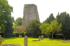
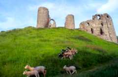
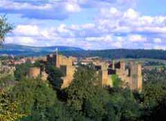
| Bridgnorth
Castle (ruin) The remains of Bridgnoth Castle are set on a cliff by the side of the River Severn. Today the castle is little more than a ruin, comprising of a 70 foot tall, 12th century Norman tower and some other small stonework built in the time of Henry II.The tower leans at an alarming angle of 15 degrees, three times greater than that of the leaning tower of Pisa. This is due to an attempt to blow it up during the Civil War.The castle was founded in 1101 by Robert de Belleme, who is reputed to have been a very nasty character. He tortured men and women and even is reported to have gouged his godson’s eyes out with his bare fingernails. He was the son of the French Earl, Roger de Montgomery, and was also a rich and powerful Norman baron who succeeded his father to become the Earl of Shrewsbury. |
 |
West
Castle Street Bridgnorth Shropshire |
|
| Broseley
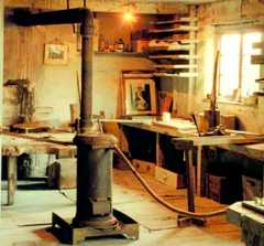
Pipeworks The museum at Broseley Pipeworks will make 'Church Wardens' of us all, in the pipe-smoking sense that is. The Broseley Pipeworks were abandoned in 1957 closing the door on 350 years of traditional pipe making skills. The site remained abandoned for many years until it was re-opened in 1996 as a part of the Ironbridge Gorge Museums. Today visitors will find the traditional tools of the job preserved, lying on benches, just as it would have looked when the workers left and the factory closed all those years ago. At one time, there were three pipe manufacturers in Broseley, making it one of the largest pipe-making areas in the world. Broseley is the site of the earliest industrial settlements. The museum here acts as a time capsule, preserving the ancient local industry of making clay pipes and other products. |
 |
Exit
J4
of M54. Follow signs
for
Ironbridge Gorge. Then follow signs for Blists Hill Museums BROSELEY PIPEWORKS CLICK |
Tel:
01952 884391 |
| Bridgnorth
Cliff Railway Company For over a century Bridgnorth Cliff Railway has been transporting the people of Bridgnorth up and down the 111 ft sandstone cliffs that separate High Town from Low Town and the River Severn. It is first and foremost a working railway; its importance to both the townspeople of Bridgnorth and to visitors to the town is undiminished by age.The railway operates two carriages on parallel tracks. Connected by steel cables, the carriages serve to counterbalance each other - as one rises to the top station, the other runs to the bottom station. The cars are now powered by an electric winding engine, but were originally driven by a system of water balance, each carriage carrying water ballast in a tank beneath the passenger compartment.
|
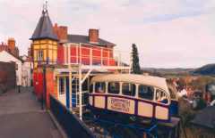 |
6a Castle
Terrace Bridgnorth Shropshire WV16 4AH From Bridgnorth Low Town car parks, walk across river bridge to Bottom Station. From Bridgnorth High Town car parks, follow fingerpost signs to Cliff Railway - Top Station is on Castle Terrace. From SVR Station, cross footbridge and follow signs. Email:-office@bridgnorthcliffrailway.co.uk |
Tel:
01746 762052 Fax: 01746 762124 |
| Buildwas
Abbey Impressive ruins of a Cistercian abbey, including its unusually unaltered 12th-century church, beautiful vaulted and tile-floored chapter house, and recently re-opened crypt chapel. In a wooded Severn-side setting, not far from the Iron Bridge and Wenlock Priory. |
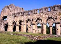 |
Ironbridge Telford Shropshire TF8 7BW BUILDWAS ABBEY CLICK |
Tel: 0871
716 1942 |
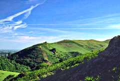
| Caer Caradoc Caer Caradoc is one of the most prominent of the South Shropshire Hills, with a summit of approximately 459 metres or 1500 feet above sea level. Close to the summit is the site of an iron age hill fort. The history of Caer Caradoc is often associated with Caradoc, one of the last British leaders to resist the Roman invasion around 43AD. The Romans called him Caractacus. According to the record (or is it legend?), Caractacus made a last stand with his followers on a hill that might possibly have been what we now know as Caer Caradoc. Caractacus was defeated and taken, as a prisoner, to Rome.It seems, though, that there are a number of other locations that might also have been the location for his defeat and capture.Caer Caradoc is one of the most prominent of the South Shropshire Hills, with a summit of approximately 459 metres or 1500 feet above sea level. Close to the summit is the site of an iron age hill fort. The history of Caer Caradoc is often associated with Caradoc, one of the last British leaders to resist the Roman invasion around 43AD. The Romans called him Caractacus.According to the record (or is it legend?), Caractacus made a last stand with his followers on a hill that might possibly have been what we now know as Caer Caradoc. Caractacus was defeated and taken, as a prisoner, to Rome.It seems, though, that there are a number of other locations that might also have been the location for his defeat and capture. |
 |
Church
Stretton Shropshire CAER CARADOC CLICK |
|
| Cantlop Bridge The great engineer
Thomas Telford was responsible for designing this
famous bridge, located just outside of the small Shropshire community
of Cantlop. Instrumental in shaping Shropshire and the West Midlands,
Telford on this occasion built a single span cast-iron road bridge for
traffic to cross the Cound Brook. The bridge is now overseen and
maintained by English Heritage.
|
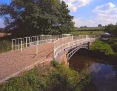 |
Cantlop, Shropshire SY5 7DB Map CANTLOP BRIDGE CLICK |
|
| Cardingmill
Valley Carding Mill Valley , above Church Stretton, cuts into the side of the Long Mynd and offers walks to the top of the escarpment and stunning views. It's in the care of the National Trust and is free to enter, although visitors have to pay to park. |
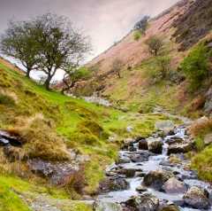 |
Chalet
Pavilion Church Stretton Shropshire SY6 6JG CARDING MILL VALLEY CLICK |
Tel: +44
(0) 1694 722631 Fax: +44 (0) 1694 723068 |
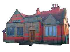
| Childhood
and Costume Museum The Museum Collection
presents a collection of replicas, cards and gifts from some of the
leading museums and galleries in Britain as well as many overseas. Most
items are produced by or with the museums themselves, so your purchases
will help the respective institutions.
|
 |
Newmarket
Building Postern Gate Bridgnorth Shropshire WV16 4AA map |
Tel: +44
(0) 1746 - 764636 |
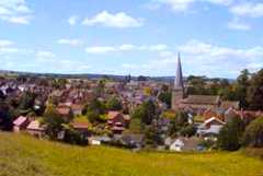
| Church
Stretton Church Stretton is a small town in southern Shropshire, England, located approximately 13 miles (21 km) south of Shrewsbury, the county town. At the 2001 census, the town's population was 4,186. The area has been settled since the Iron Age, during which a hillfort was constructed on Caer Caradoc Hill. The town was nicknamed "Little Switzerland" during the Victorian and Edwardian periods, due to its hilly terrain. The local geology is complex and incorporates some of the oldest rocks in England. Major local employers include a water-bottling plant, polymer laboratories and the tourist trade, and the town is a centre for the sport of archery. |
 |
County Branch Library, Church Street, Church Stretton, SY6 6DG E-mail: churchstretton.tourism@shropshire-cc.gov.uk |
Tel:
01694
723133 Fax: 01694 723045 |
| Cleobury
Mortimer Cleobury Mortimer is a small rural market town in Shropshire, England. The town's parish has a population of 1,962 according to the 2001 census. Although often regarded as a village, it is in fact the second smallest town in Shropshire (after Clun), having been granted a Town charter in 1253. Several pronunciations of the town's name are in use. In Cleobury itself "Clib-bree" is commonly used, while in surrounding areas such variations as "Cleb-bree" and "Clee-bree" are not unusual. The name is believed to derive from the contraction of the Old English clifu meaning a steep place and bury meaning fortified settlement. Mortimer comes from Roger de Mortimer of Normandy to whom the land was gifted after the Norman conquest. He founded the Mortimer dynasty of Marcher Lords who held power in the Welsh Marches throughout the Middle Ages and were closely involved with power struggles with successive English monarchs and other powerful Lords. Cleobury has a significant entry in the Domesday Book, and is the site of at least two castles. |
 |
Tourist Information Point - New Market Hall, Church Street CLEOBURY MORTIMER CLICK |
|
| Clun Clun (IPA: /klʌn/) is a small town in
South Shropshire, England. The town is located entirely in the
Shropshire Hills Area of Outstanding Natural Beauty. The 2001 census
recorded 642 people living in the town. The town is situated in the
Clun Valley, through which the River Clun flows. The valley is
dominated by agriculture, though some areas of woodland remain. The
town's name is taken from the River Clun, which flows from west to east
through the settlement. The River Unk joins the Clun just to the west
of the town.
The A488 and B4368 roads cross in the town of Clun. Craven Arms, Bishop's Castle and Ludlow are the neighbouring Shropshire towns, and Knighton, which is in Wales, is to the south. Nearby is Offa's Dyke and the Offa's Dyke Path. Clun Forest is to the west of the town, further upstream of the Rivers Unk and Clun. The Jack Mytton Way passes through the town as does the Shropshire Way and further significant historic routes pass through the area. The Clun Bridge, which the A488 and B4368 routes use to cross the River Clun, is at 181m above sea level, the town centre on the north bank is at 185m, while St. George's church on the south bank is situated at 193m. As well as Clun Bridge there is also a ford further downstream in the town, at Waterloo, which has recently been made usable to most motor vehicles. A third crossing point, a footbridge, exists just upstream of Clun Bridge and connects the town's main car park with the castle grounds. |
 |
Tourist Information Point Clun Garage, High Street. |
|
| Clun
Castle (ruin) Situated next to the River Clun this dramatic setting is home to the ruins and extensive earthworks of a 13th Century keep, unusually sitting on the side, rather than the top, of its mound. The castle was built as a defence on the Welsh borders and is owned and operated by English Heritage. There are several noticeboards on-site that carry a wealth of information about the history of this area. |
 |
Clun Craven Arms Shropshire Map |
Tel: 0871
716 1942 |
| Clun
Local History Museum Clun Museum is a
fascinating place to visit and is filled with
artefacts, pictures and documents that help to tell the story of this
small and interesting community. The museum was established in order to
protect the heritage of the town and its people, and is home to a large
archaeological collection that shows the earliest roots of settlements
in this region, as well as many more contemporary pieces.
|
 |
Clun Town
Hall Clun Craven Arms Shropshire SY7 8JT Map CLUN MUSEUM CLICK |
Tel: +44
(0) 1588 - 640681 Fax: +44 (0) 1588 - 640681 |
| Clun Town Trust The town trust is an
attraction and a reference point for those who
were interested in becoming more acquainted with the history of the
community. The collection of archives dates back many hundreds of
years, and there are many clues in the collection that has been put
together by the local authority as to how the people and politics of
this community have changed throughout the centuries.
|
The Square, Clun, Shropshire SY7 8JA Map |
Phone: +44 (0)1588 640026 | |
| Coalbrookedale
Museum of Iron Shropshire has a long industrial history that is connected with the iron mining industry. This museum and heritage centre is based on the site of a former mine and once would have been a bustling and dirty place of business where the mineral were extracted. The museum celebrates this rich history that has helped to shape the community into what it is today, and affected the social and political progress of the region for decades. |
 |
Exit
J4
of M54. Follow signs
for
Ironbridge Gorge. Then follow signs for Blists Hill Museums COALBROOKEDALE MUSEUM OF IRON CLICK |
Tel:
01952 884391 |
| Coalport
China Museum Coalport China Museum houses vast displays of two centuries of china, and is home to National collections of Caughley and Coalport porcelain (housed in the original riverside buildings), which were made in the factory from 1796 until 1926 when production moved to the neighbouring county of Staffordshire.Coalport was once one of the country's largest porcelain manufacturers, with a worldwide reputation for fine china. Today the award-winning museum includes a range of exhibits tracing the history of the factory and the lives and working conditions of its workforce.In the old workshops, china painting, clay modelling and china flower making take place regularly and pre-booked one-day courses are available, with expert tuition and museum entry for the enjoyment of children and adults of all ages .visitors can purchase examples of all the fine china from the museum shop. The slip room cafe serves a variety of refreshments and has a seating capacity of 70 people. |
 |
Exit
J4
of M54. Follow signs
for
Ironbridge Gorge. Then follow signs for Blists Hill Museums COALPORT CHINA MUSEUM CLICK |
Tel:
01952 884391 |
| Coleham
Pumping
Station Coleham Pumping Station
is an important piece of industrial heritage in
this region. The vast pumps have stood for much of the 20th Century.
Built in 1900, for seventy years the machinery operated within this
chapel like building under the dirty but effective power of coal
burning. The station is a real piece of industrial history and is a
fascinating place to browse around and look at the machinery.
|
 |
Longden
Coleham Shrewsbury Shropshire SY3 7DN Map COLEHAM CLICK |
Tel:
01743 361 196 Fax: 01743 358 411 |
| Craven
Arms Craven Arms is a small
town and civil parish in South Shropshire, England. The town is
surrounded to the north by the Shropshire Hills AONB, and to the south
is the fortified manor house Stokesay Castle. Craven
Arms is located on the A49 road and the Welsh Marches and Heart of
Wales railway lines, which connect it north and south to the larger
towns of Shrewsbury and Ludlow respectively. The town has a small
railway station. Craven Arms boasts many local
attractions and as a place to visit it is ideally situated for walking
and cycling. Craven Arms is a relatively new town (for Shropshire),
being only a small village "Newton" on a map of 1695. The settlement
grew when the railways came during the mid to late 19th Century. Newton
is still the name for the southeastern part of the present day town,
while the northern part is called Newington or New Inn (another small
village which existed prior to the town). The town takes its name from
the Craven Arms Hotel, situated on the junction of the A49 and B4368
roads, which in turn is named after the Lords Craven (who owned nearby
Stokesay Castle). The civil parish of Craven Arms was formed from two
older parishes — Stokesay and Halford. Small parts of the settlement
overlap into neighbouring Wistanstow and Sibdon Carwood parishes.
|
 |
Tourist Information Point - located at Secret Hills - Shropshire Hills Discovery Centre |
|
| Daniel's
Mill Picturesque working water mill with 38ft. cast iron waterwheel producing wholemeal flour traditionally. Family owned for 200 years. Guided tours for all visitors.Daniels Mill is set in the idyllic Shropshire countryside, deep in a wooded valley crossed by a 19th Century viaduct carrying the Severn Valley Railway to Bridgnorth. Visitors are taken back in time when the mill wheel turns and a steam train crosses the viaduct at the same time. See whats being turned into flour by the heavy millstones in the traditional way used for centuries and experience the sight and sounds of yesteryear.There is also an exhibition of old country tools and domestic bygones with conducted tours for all visitors to the mill. A gift shop is open and 100% wholemeal flour is available for sale, during weekends and Bank Holidays, tea, coffee and scones made from our own flour mill are available to mill visitors. We are situated near the Severn Valley Railway half a mile from the junction of the Highley (B4555) and Cleobury Mortimer (B4363) roads out of Bridgnorth.Organised parties and schools are welcome by prior appointment throughout the year. Evening parties accepted between May and end of August. Please allow up to 2 hours to visit. Reductions for parties numbering 20 and over. Light refreshments available by arrangment. DUE TO STORM DAMAGE DANIELS MILL IS NOW CLOSED. RE-OPENING DATE TO BE ADVISED. |
 |
Eardington Bridgnorth Shropshire WV16 5JL |
Tel:
01746 762753 |
| Darby
Houses At the Darby Houses you'll gain an insight into the gracious lifestyle of the Darby family.Rosehill House, was one of the homes of the Darby family and their decendents during the eighteenth and nineteenth centuries and many of the rooms are lavishly decorated with the original furniture. Adjacent to Rosehill House is Dale House, which includes the original wood-panelled study, where the great Quaker Ironmaster Abraham Darby III finalised his preparations and plans for the construction of the worlds first Iron brige. As you wonder around the Darby Houses, you can read extracts from the personal Darby family papers, giving you further insight into the thoughts of this revolutionary family. |
 |
Exit
J4
of M54. Follow signs
for
Ironbridge Gorge. Then follow signs for Blists Hill Museums DARBY HOUSES CLICK |
Tel:
01952 884391 |
| The
Dingle The Dingle was Percy Thrower’s personal garden, which has been encapsulated inside The Quarry, although remains separate by its high hedges and fences around the perimeter. Inside the Dingle, there are many little passages, allowing you to walk around the whole perimeter. During the Second World War, it was used for farming. Percy Thrower was appointed the Park Superintendent in 1946, and transformed it to what it is today. The Dingle is a perfect place just to relax: the central focal point is full of colour during the summer and the benches just above are perfect for those hot summer days in the shade. |
 |
Shrewsbury,
Shropshire Map |
|
| Dingle
Nurseries &
Gardens The beds are colour-themed to look good all year. Autumn is breathtaking, an acre of primroses in spring; spectacular plantings of shrubs trees and herbaceous. Exciting shapes in winter, always good in summer. Large nursery alongside, selling all plants for the garden. |
 |
|
Tel:-01938
555145 |
| Dorothy
Clive
Garden The Dorothy Clive Garden is intimate and informal. It embraces a variety of landscape features, including a superb woodland garden, an alpine scree, gravel garden and many fine mixed borders. Visitors will discover the great variety of form and colour and the fine views of the surrounding hilly countryside. The plant enthusiast will find many unusual species. Visitors can rest on the garden seats provided throughout the grounds and enjoy the tearoom's home-baking on the terrace lawn, while taking pleasure from the lovely views of the Staffordshire countryside. |
 |
Willoughbridge Market Drayton Shropshire TF9 4EU DOROTHY CLIVE GARDENS CLICK |
Tel: +44
(0) 1630 647237 Fax: +44 (0) 1630 647902 |
| Dudmaston
Hall The National Trust acquired this beautiful late 17th Century mansion in 1978. It houses a fascinating series of collections, including Dutch flower paintings and rare ceramics. Important 20th Century sculptures by Henry Moore and Barbara Hepworth can be found at the property, alongside a collection of Lady Laboucheres childhood clothes. The grounds are a pleasant place for walking and soaking up the historic atmosphere. |
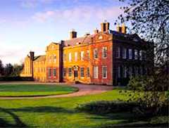 |
Quatt
Bridgnorth Shropshire WV12 6XZ From A5/A49 juncrtion Shrewsbury take directions for town centre Follow directions for Bridgnorth A458 Continue until you reach Bridgnorth Follow directions for A442 towards Kidderminster Dudmaston Hall is situated in Quatt, just off the A442. Email:-dudmaston@nationaltrust.org.uk |
Tel: +44 (0)1746 780 866
Fax: +44 (0)1746 780 744
|
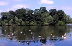
| Ellesmere Ellesmere is a small market town near Oswestry in north Shropshire, England, notable for its proximity to a number of prominent lakes, the Meres. The town is located by the side of 'The Mere', the largest natural Mere (lake) in England outside the Lake District and one of nine glacial Meres in the area. ('Glacial' means that the depression occupied by the mere was the location of a block of ice that persisted at the end of the last Ice Age.) An artificial island in the Mere was constructed in 1812 from soil dug out during the making of the gardens at Ellesmere House. This was later named Moscow Island, as Napoleon was forced to withdraw from Moscow that year. The mere has a visitors' centre and is popular with birdwatchers, many of whom visit to see Grey Herons nesting. There are eight other meres nearby: Blakemere, Colemere, Crosemere, Kettlemere, Newtonmere, Whitemere, Sweatmere & Hanmer Mere. The civil parish which constitutes the town is Ellesmere Urban - see also the parish of Ellesmere Rural. It lies in North Shropshire district. |
 |
The Mereside, Ellesmere, SY12 0HD E-mail: ellesmere.tourism@shropshire-cc.gov.uk
|
Tel: 01691 622981 Fax:
01691
622981 |
|
Enginuity |
 |
Exit
J4
of M54. Follow signs
for
Ironbridge Gorge. Then follow signs for Blists Hill Museums ENGINUITY |
Tel:
01952 884391 |
| Gallery On The Move Gallery on the Move
offers a multi-thematic art project that is
committed to developing the talents of new and emerging talents in this
area and across the country, as well as giving a forum for more
established artists to show their works. As a visitor you will be
pleased by the regular updating of the collection, making for a fresh
and exciting place to view art of the highest standards.
|
 |
Madeira Walk, Church
Stretton, Shropshire SY6 6JQ Map GALLERY ON THE MOVE CLICK |
Phone: +44 (0)1694 722130 |
| Haughmond
Abbey Haughmond Abbey is a substantial
Augustinian ruin, including
spectacular stone carvings and a roofed chapter house. An introductory
exhibition explains the history of the abbey, providing information
about site finds and their relation to monastic life. Group discounts
available..
|
 |
Upton Magna Shrewsbury Shropshire SY4 4RW Map |
Tel: 0871 716 1942 |
| Hawkstone
Hall and Gardens Hawkstone Hall is an early 18th century Georgian mansion set in extensive parkland in Shropshire, England. It now serves the church as an international centre for spiritual renewal. It has been a welcoming home to a multitude of priests, religious and lay people in their search for growth and understanding.Since 1975, Hawkstone Hall has been an important station for many in their pilgrimage of faith, providing the opportunity for rest and renewal through the three month courses. People continue to journey from the far reaches of the world to this place, to be renewed by the quickening power of the ancient Christian story |
 |
Marchamley Shrewsbury Shropshire SY4 5LG HAWKSTONE HALL CLICK |
Tel: +44
(0) 1630 685242 Fax: +44 (0) 1630 685565 |
| Hawkstone
Park Discover a hidden world of secret tunnels, concealed grottos, winding pathways and romantic valleys. Hawkstone Park is a captivating world of wonder, make believe and astounding natural beauty. An ideal day out for both young and old, discover the enchantment of Hawkstone Park and embark upon a magical mystery tour, which can last 3-4 hours. Climb to the top of grotto hill, where from Ravens Shelf you can view the panoramic view of the incredible Shropshire countryside and beyond to the Welsh hills – exhilarating! |
 |
Weston-under-Redcastle,
Shrewsbury,
Shropshire
SY4 5UY
Hawkstone Park Web site |
Tel:01939
200611 - Fax:
01939 200311 |
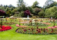
| Hodnet
Hall Gardens There have been gardens at Hodnet since the 11th century when the Heber-Percy family constructed their first house in the parkland, their serious development began in 1921 by the late Brigadier Heber-Percy. Today, the 60+ acres are renowned as amongst the finest in the country. Forest trees provide a wonderful backdrop for formal gardens planted to give delight during every season, woodland walks amongst flowering shrubs and a daisy chain of ornamental pools. The Restaurant serves light lunches and afternoon teas. Special Open Days 12 noon to 5 p.m. |
 |
Hodnet Market Drayton Shropshire TF9 3NN HODNET HALL GARDENS CLICK |
Tel: +44
(0)1630 685 786 Fax: +44 (0)1630 685 853 |
|
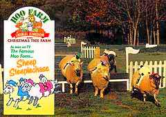
Hoo Farm
Animal Kingdom
A
real children’s paradise with
animals
and fun, bottle-feeding lambs, milking, egg collecting, animal
handling, plus
the famous sheep steeplechase. Junior quad bikes, pony rides, craft and
play
areas, rifle range, gift shop and tea room. Visit Hoo at Halloween and
Christmas
World from 23rd November onwards.
|
 |
|
Tel:01952
677917 - Fax:
01952 677944
|
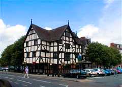
| House
on Crutches Museum Delightful museum illustrating the life of the town. Much of the collection has been donated or loaned to the museum by the local inhabitants and serves to paint a lively picture of life in a thriving Victorian town which has had a market since 1128. There are four display rooms in this very unique early 15th century building and the stewards are all volunteers who enjoy sharing the delight of visitors from far and wide.Because of the nature of the building itself there is very limited access for visitors with mobility difficulties. The two ground floor rooms, for instance, have one step down from street level and two steps up into the second room - so not totally impossible. The two upper rooms are accessed by a staircase.
|
 |
High Street Bishops Castle Shropshire SY9 5AA map HOUSE ON CRUTCHES CLICK |
Tel: +44
(0)
1588 630007 |
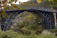
| The
Iron Bridge Ironbridge is a
settlement on the River Severn, at the heart of the Ironbridge Gorge in
Telford, Shropshire, England. It lies in the parish of The Gorge, in
the borough of Telford and Wrekin. The village developed beside, and
takes its name from the famous Iron Bridge, a 30 metre (100 ft) cast
iron bridge that was built across the river there in 1779.The area
around Ironbridge is described as the "Birthplace of the Industrial
Revolution" because it is near a the place where Abraham Darby I
perfected the technique of smelting iron with coke, allowing much
cheaper production of iron. The grandson of the first Abraham Darby,
Abraham Darby III, built the famous bridge - originally designed by
Thomas Farnolls Pritchard - to link the two areas. Construction began
in 1779 and the bridge opened on New Year's Day 1781. Soon afterwards
the ancient Madeley market was relocated to the new purpose built
square and Georgian Butter Cross and the former dispersed settlement of
Madeley Wood gained a planned urban focus as Ironbridge, the commercial
and administrative centre of the Coalbrookdale coalfield. The Iron
Bridge proprietors also built the Tontine Hotel to accommodate visitors
to the new Bridge and the industrial sights of the Severn Gorge. On the
hillside above the river are situated the stone-built 16th century
hunting Lodge at Lincoln Hill, many 17th and 18th century workers
cottages, some imposing Georgian houses built by ironmasters and mine
and canal barge owners, and many early Victorian villas built from the
various coloured bricks and tiles of the locality.
|
 |
The Wharfage, Ironbridge Telford, TF8 7AW Tel: 01952 432166 Fax: 01952 432204 E-mail: tic@ironbridge.org.uk Adjacent to A4169, Ironbridge, Shropshire TF8 7JU |
Tel:
01952 432166 Fax: 01952 432204 |
| Ironbridge
Gorge Museums Ironbridge is a World Heritage
Site,
chosen for its outstanding character and the historic importance its
monuments.
The ten Ironbridge Gorge Museums tell this revolutionary story. Most
famous
is the Iron Bridge built by Abraham Darby in 1779. The Museums
catalogue the
remarkable innovation and invention which followed. The social history
of
the managers and men of the Industrial Revolution is brought to life
through
the illustration and demonstration of their labours - most vividly at
Blists
Hill Victorian Town, set in a 50 acre woodland site, where you can step
back
in time. The 19th Century ceramic industry also flourished, and
original bottle
ovens are the backdrop to the China Museum, where the premier
collection of
Coalport China is exhibited. The original factory at Jackfield houses a
kaleidoscopic
collection of tiles and art pottery. Both Museums offer 'hands on'
workshops.
A Museum of Iron, the Broseley Pipeworks and the Tar Tunnel complete
your
visit to the 'most extraordinary district in the world'. New for 2003
is
Enginuity - it opened August last year and is a hands-on Design
Technology
Centre. Passport Tickets admit you to all ten Museums in your own time. |
 |
Exit J4
of M54. Follow signs
for
Ironbridge Gorge. Then follow signs for Blists Hill Museums The IRONBRIDGE GORGE MUSEUM TRUST, Coach Road, Coalbrookdale, Telford, TF8 7DQ A QUICK TASTER OF IRONBRIDGE CLICK |
Tel: 01952 435 900 Fax:01952 435 999 |
| Jackfield
Tile Museum You are invited to wander through
the
original gas lit trade floor of the factory and see machinery and
infrastructure that was in place to produce these famous British tiles.
The main museum and heritage centre is filled with excellent examples
of tiles that have been produced by the factory over the years. A real
experience for anyone interested in industrial art or technological
history in Britain.
|
 |
Exit
J4
of M54. Follow signs
for
Ironbridge Gorge. Then follow signs for Blists Hill Museums JACKFIELD TILE MUSEUM CLICK |
|
| Langley Chapel Set alone in the
charming Shropshire countryside, this small chapel is
managed by English Heritage which has erected several informative
information points, telling the history of the church. The atmospheric
interior contains a perfect set of 17th Century timber furnishings that
have been well preserved along with a musician’s pew. The church has
played an important role in this community for many centuries and
remains a popular attraction.
|
Langley, Acton Burnell, Shropshire SY5 6AP Map |
||
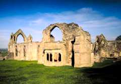
Lilleshall AbbeyLilleshall Abbey offers extensive, evocative and remarkably peaceful remains of the abbey church and cloister buildings, surrounded by lawns and ancient yew trees. It was later a Civil War stronghold but much of the church still survives and it is unusually visible from gallery level. |
Lilleshall, Newport,
Shrewsbury, Shropshire TF10 9HW |
Phone: +44 (0)121 625 6820 | |
|
Llanymynech
Rocks A unique opportunity to discover our industrial past. As one of only 3 remaining Hoffman Kilns in the country, this is a nationally significant industrial heritage area. The site forms part of the limeworks landscape, from rock extraction on the high cliffs of Llanymynech Rocks, down the inclined plains through to the kilns and beyond, transporting the finished lime via the Montgomery Canal and Railway. This area was a major centre of the lime industry until the beginning of the 1900's and retains a number of important features of industrial archaeology. The impressive 39 metre high chimney of the Hoffman Kiln dominates the site and provides visitors with a focal point to a varied site. Short circular walks (30 mins - 2 hrs) take you past impressive lime kilns, through woodland, along canals and disused railways, and across grazed pasture with views of Llanymynech Rocks, a Shropshire Wildlife Trust reserve. |
 |
c/o
Heritage Centre, 2 Church
Terrace, Oswestry, SY11 2TE Email:- ot@oswestry-welshborders.org.uk |
Tel:-01691
662753 |
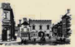
| Ludlow Ludlow is a market town in Shropshire, England close to the Welsh border and in the Welsh Marches. It lies within a bend of the River Teme, on its eastern bank, forming an area of 350 acres (1.4 km²) and centred on a small hill. Atop this hill is the site of Ludlow Castle and the market place. From there the streets of the medieval town slope downward to the River Teme, and northward toward the River Corve. The town is in a sheltered spot beneath the Clee Hills which are clearly visible from the town . With a population of around 10,000, Ludlow is the largest town in the South Shropshire district and home of the district council headquarters . Ludlow has nearly 500 listed buildings . They include some fine examples of medieval and Tudor-style half-timbered buildings including the Feathers Hotel. The parish church, St Laurence Church, is the largest in the county. The name 'Lodelowe' (Welsh: Llwydlo) was in use for this site before 1138. At the time this section of the Teme river contained rapids, and so the hlud of Ludlow came from 'the loud waters', while hlaw meant hill. Thus Ludlow meant a place on a hill by a loud river. Some time around the 12th century weirs were added along the river, taming these rapid flows. Later in the same century the larger outer bailey was added to the castle. |
 |
Castle Street, Ludlow, SY8 1AS email: ludlow.tourism@shropshire-cc.gov.uk
|
Tel:
01584 875053 Fax: 01584 877931 |
|
Ludlow
Castle |
 |
Castle
Square Ludlow
Shropshire SY8
1AY From the junction of the A5/A49 (S) Shrewsbury Take the A49 south to Ludlow Follow signs for Ludlow Town centre On Corve street turn right down knig street and follow the road to the castle. Tel:-01584 873355 Email:-info@ludlowcastle.com LUDLOW CASTLE CLICK |
Tel:-01584 873355 |
| Ludlow Museum Ludlow Museum is a
well-loved part of the community and holds a wealth
of information on a range of subjects that relate to the growth and
development of this town. There is a vast quantity of artefacts,
documents, photographs and other interesting testimonials that have
been passed down through the oral tradition for visitors to examine and
piece together here.
|
Castle Street, Ludlow, Shropshire SY8 1AS Map |
Phone: +44 (0)1584 875384 | |
|
Ludlow
Racecourse |
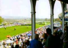 |
|
|
| Market
Drayton Market Drayton is a small market town
in north Shropshire, England. It is on the River Tern, between
Shrewsbury and Stoke-on-Trent, and was formerly known as "Drayton in
Hales" (c. 1868) and earlier simply as "Drayton" (c. 1695). Market
Drayton is on the Shropshire Union Canal and on National Cycle Route
75. The A53 road by-passes the town. Although near the Western edge of
England, very close to Wales, it can be said to be the most central
town in England by means of a geometric exercise : if one draws a
rectangle just touching the north, south, east and west extremities of
the country (including the Isles of Scilly), the central point falls
about two miles south of the town, near the village of Woodseaves.
|
 |
49 Cheshire Street, Market Drayton, TF9 1PH. Email: marketdrayton.tourism@shropshire-cc.gov.uk
|
Tel: 01630 6512139
Fax: 01630 652139 |
|
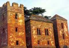
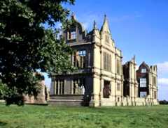
Moreton
Corbett Castle |
 |
Take the
A53 north-east from
Shrewsbury
to centre of Shawbury, and follow signs to the castle on the B5063. |
|
|
Moreville Hall
A stone built Elizabethan house of some note, Morville Hall has been owned and maintained by the National Trust since 1965. Altered and enlarged in the 18th Century, the house is set in an attractive series of landscaped gardens. There are still live-in tenants at the house that means that visits can only be made if prior written appointments are made. |
Bridgnorth, Shropshire
WV16 5NB Map |
Phone: +44 (0)1746 780838
|
|
| The
Mount Charles Darwin was born at The Mount in February 1809. Although you can’t actually enter the house, you may look around the grounds during normal working hours, as the district valuer now occupies the house. The Mount was built by Charles’ father, Robert Darwin in 1800, to house his wife and six children. Around the side of the house you can see the greenhouse, built by Robert Darwin, to house a banana tree on Charles’ advice. You can also see the kitchen garden and orchard, where Charles’ would scrump apples as a child. |
 |
Frankwell,
Shrewsbury, Shropshire Map |
|
| Museum of The Gorge The Museum of the Gorge provides an excellent introduction to the valley and its attractions. The museum building was originally a somewhat gothic riverside warehouse where the fine porcelain goods from the Coalbrookdale company began there journey to the rest of the world.The museum houses an impressive 40ft scale model of the town, as it was in 1796 and you can use the latest interactive computer technology to discover the environmental effects of the years of industry have had on the Gorge.The Museum of the Gorge is the ideal place to learn about the history of the severn and it offers its visitors hands-on experiences. |
|
Exit J4 of M54. Follow signs for Ironbridge Gorge. Then follow signs for Blists Hill Museums MUSEUM OF THE GORGE CLICK |
Tel:
01952 884391 |
| Much
Wenlock Much Wenlock, earlier known simply as "Wenlock" ("White Place") in Celtic ("Gwyn-loc"), is a small town in central Shropshire, England. It lies in the Bridgnorth district, on the A458 road between Shrewsbury and Bridgnorth. Nearby, to the northeast, is the Ironbridge Gorge. The population of the town's parish, according to the 2001 census, is 2605.The town grew around an abbey or monastery founded in 680 by Merewalh, a son of King Penda of Mercia. King Penda installed his daughter Milburga as Abbess in 682. Milburga of Wenlock was credited with many miraculous works. The abbey flourished until around 874 when a Danish Viking attack occurred. In the 11th Century another religious house was built on the same site by Leofric, Earl of Mercia and Countess Godiva his wife. In the twelfth century this was replaced by the Priory a Cluniac priory, established by Roger de Montgomerie after the Norman Conquest, the ruins of which can still be seen and which is now in the hands of English Heritage. It prospered until the Dissolution of the Monasteries in 1539. |
 |
|
Tel
: 01952 727679 Fax : 01952 727679 |
| Much Wenlock Museum Much Wenlock Museum is
dedicated to the people and institutions that
make up this area and brings together a good-sized collection of pieces
that date from many hundreds of years of interesting history. You will
enjoy browsing through old maps and photographs as well as antique
furniture, paintings and other ancient artefacts that help to bring
life to the story of the region.
|
High Street, Much Wenlock,
Shropshire TF13 6HR Map |
Phone: +44 (0)1952 727773 | |
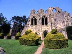
Much Wenlock PrioryWenlock
Priory
today consists of picturesque
ruins of a large priory of Cluniac monks and enjoys a pastoral setting
on the edge of lovely Much Wenlock. Its grandeur can still be traced in
the ruins of its 13th Century church, ornate Norman chapter house and
rare monks’ washbasin.
|
 |
Much
Wenlock, Shropshire TF13 6HS Map |
Phone: +44 (0)1952 727 466 |
| Mythstories The oral tradition is
one of the most powerful in our society, and many
of the things that we believe and take as fact have been passed down
from generation to generation by this method. This museum carries a
large and interesting archive of ideas and stories, myths and legends
that have been transferred in this way over a period of many hundreds
of years.
|
 |
Aston Street, Wern, Shropshire SY4 5AU Map info@mythstories.com MYTHSTORIES CLICK |
Phone: +44 (0)1939 235500 |
|
Northgate
Museum
The Northgate Museum is
located in Bridgnorth
and is filled with an archive of treasures that relate to the people
and institutions of this area. From the very earliest examples of
archaeological artefacts that have been discovered here, all the way
through to modern antiques; this collection is wide-ranging and
beautifully arranged. Highlights include an Edwardian till and a model
of Trevithick’s Steam Engine.
|
 |
Northgate, High Street,
Bridgnorth, Shropshire WV16 4ER Map NORTHGATE MUSEUM CLICK |
Phone: +44 (0)1746 762830 |
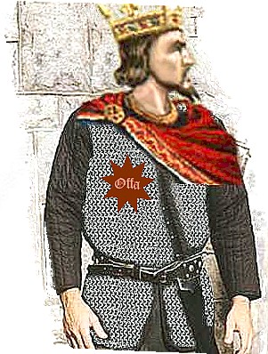
| Offa's
Dyke was constructed in the late
eighth
century on the orders of King Offa. The Dyke is the longest
archaeological
monument in Britain. The Dyke was originally contructed to mark the
boundary
between the Kingdom of Mercia and the Welsh Kingdoms to the west;
probably
intended to serve as a means of regulating access to and from Wales and
today
lengths of the Dyke form part of the National boundary between England
and
Wales. See our Mercian History page.
|
 |
Nr.
Oswestry, Shropshire |
Tel:
01547 528192 |
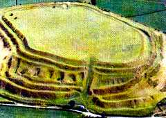
| Oswestry
Hillfort Just a mile north of the town of
Oswestry in
Shropshire is one of the best examples in the country of an Iron Age
hillfort. Old Oswestry is on a huge scale (around 40 acres), with its
massive earthwork ramparts and salients. Excavations have failed to
unlock its mysteries and so there is a quite unique atmosphere. The
site is freely accessible to the public.
|
 |
Oswestry,
Shropshire Map www.english-heritage.org.uk |
Tel:
01691 671323 |
| Oswestry
Town Oswestry (pronounced /ˈɒzwəstɹɪ/) is a town and civil parish in Shropshire, England, very close to the Welsh border. It is at the junction of the A5, A483, and A495 roads. The town is the administrative headquarters of the borough of Oswestry and is the third largest town in Shropshire, following Telford and Shrewsbury. The 2001 Census records the population of the town as 16,660, and a 2008 estimate suggests the population has grown to 17,116.The area has long been settled. Old Oswestry is the site of a large Iron Age hill fort with evidence for occupation dating back to the 550s BC. The Battle of Maserfield is thought to have been fought here in 642, between the Anglo-Saxon kings Penda and Oswald. Oswald was killed in this battle and was dismembered; according to a legend, one of his arms was carried to an ash tree by a bird, an eagle, and miracles were subsequently attributed to the tree (as Oswald was considered a saint). Thus it is believed that the name of the site derived from a reference to "Oswald's Tree". The spring Oswald's Well is supposed to have originated where the bird dropped the arm from the tree. Offa's Dyke runs nearby to the west. |
 |
Heritage Centre, 2 Church Terrace, Oswestry, SY11 2TE E-mail: ot@oswestry-welshborders.org.uk
Mile End, Oswestry, SY11 4JA E-mail: oswestry.tourism@oswestry-bc.gov.uk Oswestry Town Council |
Tel:
01691 662753 Fax: 01691 65811 Tel: 01691 662488 Fax: 01691 662883 |
|
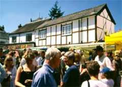
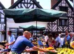
Oswestry
Market The weekly market in Oswestry was given its charter in 1190, and with over 100 stalls its the largest market in the Welsh borders.The influence of Wales is still strong and as you walk around, you'll hear a distinct fusion of languages. You'll also see it reflected in the unique creativity of the local arts and crafts.Oswestry actually boasts two markets - one in town at the Horse Market & Bailey Head. The other, outside town, is the Oswestry Smithfield livestock auctions. If you fancy fresh farm produce and home-made foodstuff, plus the necessary bargain ofer, you'll enjoy Market Day hugesly.Markets in Oswestry take place on Wednesdays and Saturdays. |
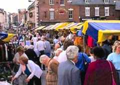 |
OSWESTRY
MARKET OSWESTRY MARKET OSWESTRY SHROPSHIRE Email:- enquiries@oswestry-tc.gov.uk |
Tel:-01691
680222 |
| Oswestry Transport
Museum This museum is located
in Shropshire and carries a large and
interesting archive and collection that is related to land transport.
The history of transport in this area is discussed, along with a more
general overview of the way that public and private transport has
changed throughout the years. One of the most visited exhibitions in
the museum is dedicated to the history of the Cambrian Railway and
there are eleven full-sized engines on display.
|
Oswald Road, Oswestry, Shropshire SY11 1RE Map |
Phone: +44 (0)1691 671 749 | |
| Quarry
Park As you enter Quarry Park, you will cross a magnificent suspension bridge, as you can see in the photograph, which is the most eye-catching part of the park. The park itself holds the Shrewsbury Flower Show and the Shrewsbury Summer Season every year, which includes open air plays, concerts and comedy. The Quarry Park is perfect to start off your day in Shrewsbury: your walking distance from sights such as St. Chad’s Curch and the Abbey Gardens. |
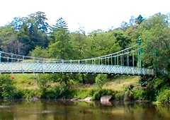 |
Shrewsbury,
Shropshire |
|
| Royal
Air Force Museum -Cosford These wartime hangars have been
heated to
provide a pleasant atmosphere in which to browse an extensive
collection of Second World War aircraft, as well as older pieces that
have been involved in great achievements of flight over nearly a
hundred years of history. One of the largest aviation collections in
the country, there are nearly eighty aeroplanes on display as well as
material related to submarines and nuclear warfare.
Open
daily 10am - 6pm (last admission 4pm) including Bank Holidays.
Closed
24-26 December, 1, 7-11 January 2008. Entry and
parking
are
both FREE of charge. |
 |
From
junction 3 of the M54 take the A41 south towards Wolverhampton.
Follow brown signs to Royal Air Force Museum. |
Tel:-01902 376200 |
| Rays
Farm Country Matters At
Rays Farm you will see a variety of deer,
friendly goats and farm animals. Watch the grace and splendour of many
owls and explore a streamside walk of myth and magic woodcarvings. Back
at the farm, take a rest in the tea shop or browse around our
interesting selection of toys and gifts. So bring the family, bring
your friends... to where the country matters. A great day out for all
ages.
|
 |
From
the juncton of the A5/A458 (S) Shrewsbury take the A458 south towards
Bridgnorth.
From Bridgnorth take the B4363 south to Billingsley. Pass Billingsley
and
follow signs to Rays farm.Map |
Tel:-01299
841255 |
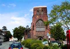
| St.
Chad’s Church overlooking
the Quarry Park, is
one of
the largest circular naves (open space in the centre of a church) in
the country.
Just outside in the churchyard, you can see Ebenezer Scrooge’s “grave”,
which
was used in the filming if “A Christmas Carol”. The Old St. Chad’s
Church
was situated in the centre of town, but after its tower collapsed in
the
late 1700’s, the new St. Chad’s was built where it can be found now.
Inside the church you can see the spectacular art of the disciples
carrying Jesus down from the cross to the tomb.
|
 |
Claremont
Hill, Shrewsbury,
Shropshire
SY1 1RD
|
Tel:01743
235834
|
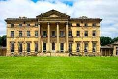
| Shrewsbury The town was known to the ancient Britons as Pengwern, signifying "the alder hill";and to the Anglo-Saxons as Scrobbesburh (dative Scrobbesbyrig), which has several meanings; "fort in the scrub-land region", "Scrobb's fort", "shrubstown" or "the town of the bushes". This name was gradually corrupted in three directions, into 'Sciropscire' which became Shropshire, into 'Sloppesberie', which became Salop/Salopia (the historical name for the county), and into 'Schrosberie' which eventually became the name of the county town, Shrewsbury. Its Welsh name Amwythig means "fortified place". Shrewsbury is known as a town with significant medieval heritage, having been founded ca. 800 AD. It was during the late Middle Ages (14th/15th Centuries) when the town was at its height of commercial importance. This was mainly due to the wool trade, a major industry at the time, with the rest of Britain and Europe, especially with the River Severn and Watling Street as trading routes.[16] It is believed that Henry VIII intended to make Shrewsbury a cathedral city after the formation of the Church of England, but the citizens of the town declined the offer |
 |
The Music Hall, The Square, Shrewsbury, SY1 1LH E-mail: tic@shrewsburytourism.co.uk
|
Tel:
01743 281200 Fax: 01743 218213 |
| Shrewsbury
Abbey As well as Shrewsbury Abbey being a practicing, Anglican church, it’s also filled with historical facts and evidence from the past. In the 1980s, the Abbey was restored to its original form, including a herb garden, which would’ve been used by monks for spiritual, medicinal and culinary use. The most famous link with Shrewsbury Abbey is Brother Cadfael, a fictional character in murder mysteries by Edith Pargeter. Cadfael was a herbalist Benedictine monk, which the herb garden was based on, and opened by the author. |
 |
|
Tel:
01743 232723
|
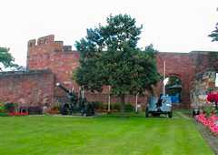
| Shrewsbury
Castle & Shropshire
Regimental
Museum Shrewsbury
Castle started off life
as
a Norman castle, owned by Roger de Montgomery. The only part which
remains
from the original castle is the entrance. Laura’s Tower, which was
built by
Sir William Paulteney offers the best vantage point for panoramic views
around
the town. The Regimental Museum, which is situated just outside the
castle
itself, hold many artefacts from the 1700’s to present day, including
uniforms,
medals, and munitions.
|
 |
Castle
Gates, Shrewsbury,
Shropshire
From Junction A5/A49 Shrewsbury follow signs for Meole Brace At Meole Brace roundabout take the 1st exit onto Roman Road - A5191 (signposted Belle Vue, Porthill) Continue forward onto Coleham Head - A458 Turn left onto Wyle Cop - A5191 (signposted Town Centre) Turn right onto Mardol Quay - A488 (signposted Town Centre, Ellesmere, Whitchurch, Newcastle) Turn right onto Castle Gates - A5191 Map |
Tel:
01743 358516 -
Fax: 01743 358411 |
| Shrewsbury
Museum Shrewsbury
Museum was reopened in
January
2001. The museum is housed in a traditional timber-framed Tudor
building,
and a stone Tudor dwelling. Inside the museum, you can find many
artefacts
from natural history and geology, local history, and archaeology. The
archaeology
section features many pieces as early as 12,000 BC. There is also a
small
section assigned to art. As well as the permanent displays, the museum
holds
many temporary exhibitions.
|
 |
Rowley’s
House, Barker Street,
Shrewsbury,
Shropshire SY1 1QH
Email:-museums@shrewsbury-atcham.gov.uk SHREWSBURY MUSEUM CLICK |
Tel
01743
361196 - Fax: 01743 358411
|
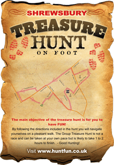
| Shrewsbury Treasure Hunt No prior knowledge of Shrewsbury is required as all clues are solved by observation. Both young and old will be fascinated whilst getting out for a couple of hours seeing the sites and solving the clues. Children will enjoy beating adults to solve the clues! We even supply a map just in case you get lost. The answers are at the back of the book so you can check any unsolved ones before you leave.The hunt starts at the Tourist Information Centre , The Square, Shrewsbury, SY1 1LH. From Shrewsbury or just visiting, you will be surprised at how much you walk past without even noticing. We so often walk around blinkered without appreciating the great features which make our towns and cities fabulous. By following our hunt these things will be highlighted rather than hidden away. Our Shrewsbury treasure hunt packs contain all the necessary elements for you need including maps, clues, answer sheet, and tips on how to get things going. |
 |
||
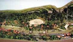
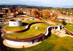
| Shropshire
Hills Discovery
Centre Take a walk in our 25 acres of meadowland. Visit our craft display area where we regularly have different exhibitions. Soak up the geological, historical, archaeological and cultural significance. Beneath the amazing grassy roof is a series of galleries telling the story of the Shropshire Hills, the folk who lived here and the forces which shaped the landscape. Discover the writers, poets and artists who have drawn inspiration from this unique countryside and step inside our simulated hot-air balloon ride for a bird's eye view of those "Blue Remembered Hills".The Secret Hills Discovery Centre in Craven Arms is housed in an extraordinary grass-roofed building designed to echo the hill forts in the surrounding Shropshire countryside. The centre allows the visitor to step inside and discover for themselves just how the Shropshire landscape evolved into what we see today. The exhibition guides the visitor through a geological history of the Shropshire Hills pointing out the key features of the Shropshire landscape. You'll also see the Shropshire Mammoth - surprising perhaps as they haven't walked around Shropshire since the end of the last Ice Age some 13,000 years ago. It is only with modern forensic research that visitors can see exactly what Shropshire looked like when mammoths walked the Shropshire plains. |
 |
|
Tel:-01588 676000 |
|
Stokesay
Castle Set in a green valley
amid the Shropshire
countryside stands Stokesay Castle, England’s most delightful fortified
manor house. This beautiful house dates back to the 11th Century and
its Great Hall remains unaltered since it was built in 1291. Admire the
superb timber-framed gatehouse or take the lovely moat walk around the
castle. Finally, enjoy the tea room at Stokesay in tranquil cottage
garden surroundings, and watch time pass... very slowly. Stokesay
Castle also has an extensive gift shop.
|
 |
Near
Ludlow, Shropshire SY7 9AH Map |
Phone: +44 (0)1588 672544 |
| The
Story of Drayton We call it “The Story of Drayton”, because that’s exactly what it is.It’s all about the Town. Everything in the Collection was donated by the people of Market Drayton, used by them, and often manufactured by them. So the families, lifestyle, events, and stories emerge from all these bits and pieces.... more than 10,000 of them, collected over the course of nearly thirty years.In the Shop we sell the Town - a potted history in five quick chapters, from earliest times to the present. There’s also the odd diversion and digression.In the House behind we show off our home.... with the trophies on the mantelpiece, china in the dresser, medicine in the bathroom, and so on in kitchen, yard and shed. Here, as you can imagine, the past often rubs shoulders with the present.The things you can see range from a prehistoric plant stem to a hand-pulled hearse, a bottle collection, horse-drawn seed drill, and Victorian mangles.And you’ll find stories ranging from Clive of India’s Pies to Gingerbread Secrets, the WC War, and Death at the Theatre.... not to mention Arthur Phillips’ vertical take-off aircraft of 1908. At present we’re open all day Wednesday (10.00-16.00), Saturday morning (10.00-13.00), and Sunday afternoon (14.00-17.00), and admission is free. If you can’t make these times, give us a ring, and we’ll see what we can do. Our season is normally from April to October. |
 |
Museum & resource Centre, 53 Shropshire Street, Market Drayton, Shropshire TF9 3DA Email:-sublime16@btinternet.com STORY OF DRAYTON CLICK |
Tel:-01630 657455 |
| Tar
Tunnel The Tar tunnel is another remarkable and interesting feature of the Ironbridge Gorge.Located along the banks of the River Severn in the Village of Coalport, the tunnel starts near the foot of the Hay Inclined Plane and runs under the hill for at least 1000 yards.The Tar tunnel was dug from the hillside in 1787 - probably in connection with the nearby coal workings. The miners struck a gushing underground spring of thick, treacle-like natural bitumen that was one of the great curiosities of the eighteenth century and still oozes from the walls today.It was used to treat ropes and for caulking ships however small amounts of the bitumen was processed, bottled and packaged as 'Betton's British Oil'. It was sold as a remedy for 'rheumatic and scorbutic affections'. |
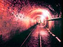 |
Exit
J4
of M54. Follow signs
for
Ironbridge Gorge. Then follow signs for Blists Hill Museums TAR TUNNEL CLICK |
Tel:
01952 884391 |
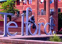
| Telford Telford (pronunciation (help·info); IPA: /ˈtɛlfɚd/) is a large new town in the borough of Telford and Wrekin and ceremonial county of Shropshire, England, approximately 13 miles (21 km) east of Shrewsbury, and 30 miles (48 km) west of Birmingham.[1] With a population of 138,241 people (2001 census), and a projected population growth within the next 20 years to over 200,000, Telford is by far the largest town in Shropshire, and one of the fastest growing towns in the United Kingdom. It is named after Thomas Telford, the famous civil engineer. The town was built in the 1960s and 1970s as a new town on previously industrial and agricultural land. Similarly to other planned towns of the era, Telford was created from the merger of other, smaller settlements, most notably the towns of Wellington, Oakengates, Madeley and Dawley. Telford Shopping Centre, a modern shopping mall, was constructed at the new town's geographical centre, along with an extensive Town Park. The M54 motorway was completed in 1983, connecting the town with the West Midlands conurbation, and vastly improving the transport infrastructure between Telford's component settlements. Telford also incorporates the northern half of Ironbridge Gorge, a scenic tourist destination and UNESCO World Heritage Site. The town advertises itself as "The Birthplace of Industry", due to its proximity to Coalbrookdale, and its own activity during the Industrial Revolution as part of the Shropshire Coalfield. The River Severn flows along its southernmost boundary. |
 |
The Telford Shopping Centre, Telford, TF3 4BX E-mail: info@telfordshopping.co.uk TELFORD SHOPPING CENTRE CLICK Telford Photos http://en.wikipedia.org/wiki/Telford |
Tel:
01952 230032 Fax: 01952 291723 |
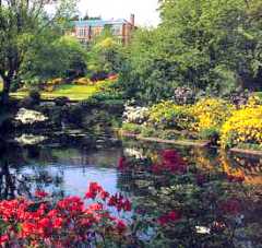
| Walcot Hall There are 30 acres of
garden and arboretum at Walcot Hall, which are
open to the public on Friday, Saturdays, Sundays and Mondays throughout
April to October. Entry is between 12 and 4.30p.m. with admission
£2
per adult and free for children under 16. There are winding walks,
fishing pools and magnificent specimen trees to be seen. The grounds
are particularly beautiful in May and early June when there is a
profusion of Rhododendrons and Azaleas.
|
 |
Lydbury North, Shropshire SY7 8AZ Map enquiries@walcothall.com WALCOT HALL CLICK |
tel: +44 (0)1588 680570 |
| Wem Wem is a small market town in Shropshire, England. It is the administrative centre of North Shropshire District Council, which has its headquarters at Edinburgh House in the centre of Wem . The town has a railway station - Wem railway station on the Shrewsbury to Crewe railway line. Nine miles south of the town is the county town of Shropshire, Shrewsbury. The civil parish which constitutes the town is Wem Urban . The area now known as Wem is believed to have been settled prior to the Roman Conquest of Britain, by the Cornovii, Iron Age settlers. The town is recorded in the Domesday Book as consisting of four manors. In 1202, Wem became a market town. The town supported the Parliamentarians in the English Civil War, and was subject to an attack by Lord Capel, in which the town held off the attackers. In 1677, a fire destroyed many of the wooden buildings in the town. Within the town the Sweet Pea was first born, under the name the Eckford Sweet Pea, after its inventor, nursery-man Henry Eckford. He first introduced a variety of the sweet pea in 1882, and set up in Wem in 1888, developing and producing many varieties. There is a road to signify the Eckford name, called Eckford Park (within Wem). Each year, the Eckford Sweet Pea Society of Wem hold a Sweet Pea Festival. In Victorian times, the town was known as "Wem, where the sweet peas grow".The name of the town is derived from the Saxon "Wamm", meaning a marsh, as marshy land exists in the area of the town. Over time, this was corrupted to form "Wem". |
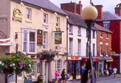 |
|
|
| Weston
Park & Gardens Weston Park is a house and gardens that is overseen by a charitable foundation. The interior of the house contains a wealth of treasures, ranging from the French Gobelin Tapestries to the Oriental ceramics and royal makers Morel and Hughes. Other exhibits include paintings by masters such as Van Dyck, Gainsborough and John Constable. The grounds offer a fantastic place to walk and enjoy pastoral splendour. |
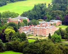 |
Weston-under-Lizard,
Telford,
Shropshire TF11 8LE From the M54 take junction 3. On the roundabout take a left on the A41 towards Newport. At the next roundabout take a right towards Weston under Lizard. Finish on the right at Weston Park (signposted) Email:- enquiries@weston-park.com WESTON PARK CLICK |
Tel:-01952
852100 |
| Whitchurch Whitchurch is a market town in North
Shropshire, England. It is the oldest continuously inhabited town in
Shropshire. According to the 2001 Census, the population of the
town is 8,673, and a more 2008 estimate puts the population of the town
at 8,934. The town is located in the Whitchurch Urban civil
parish, and is twinned with the French town of
Neufchâtel-en-Bray. Originally a settlement founded by the Romans
around AD 52 or 70, it was called Mediolanum, meaning The place in the
middle of the plain. The settlement was located on a major Roman route
between Chester and Wroxeter and Roman artifacts can be seen at the
Whitchurch Heritage Centre. The current name comes from White church,
and refers to a church (from Norman times) made from white stone. As
might be expected, there are other towns of the name Whitchurch in
England. The current church of St Alkmund, built in 1712 using
sandstone, stands on the site of the Norman church.
|
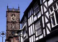 |
12 St Mary's Street, Whitchurch, SY13 1QY E-mail: whitchurch.heritage@ukonline.co.uk |
Tel:
01948 664577 Fax: 01948 665432 |
Whiteladies PrioryBuilt on the grounds of a medieval nunnery, it was to White Ladies that Charles II then a Prince was first taken, after fleeing from Worcester. He arrived at White Ladies Priory on Thursday 4th September 1651 after riding throughout the night and was admitted by a servant of the house named George Penderel.The name 'White Ladies' refers to the nuns who lived there who wore white (undyed) habits.Whilst the large timber-framed nunnery has now gone, the remains of the nunneries medieval church, and the nineteenth boundary wall of the small graveyard still remain.In 1535 White Ladies Priory was valued at having an annual income of less than £17 and, owing to an Act of Parliament in 1536 it was shut as its annual value was less than the £200 needed to keep the Priory open.The Priory is located close to Boscobel House (which grounds include the famous Royal Oak), which is about a mile up the road, where Charles II briefly stayed.The Priory is also rumoured to be where Queen Guinevere retired to after the death of King Arthur. |
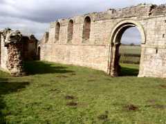 |
WHITELADIES
PRIORY CLICK |
|
| Whittington
Castle
Looking at the remains of this once extensive Marches Castle
one wonders why
this particular site was chosen. In most cases castles had natural
defensive
features to prevent easy access for attacking forces, such as a river,
steep
cliffs or deep moat. The highest land in the village, Pen-y-bryn, would
have
given excellent views towards Offa's Dyke, over which the Welsh raiders
frequently invaded English territory. It was protection provided by the
treacherous
marshlands surrounding the site which was the decisive factor in its
choice for the first earthworks and wooden Castle. William Peverel
built the Norman Motte and Bailey castle after the demolition
of the previous stronghold built at the time of King Offa, probably of
wood with
a stockade of sharp posts. William Peverel had no male heir so his
eldest daughter Mellet inherited the castle.
The victor of a tournament for her hand in marriage was Warin de Metz
of
Lorraine who founded a long line of Fitzwarines. They held the castle
until 1420.Much of the remains of the keep which can be reached by
climbing the iron
circular stairs date from a rebuilding in 1222. The outer gatehouse
with two
towers had a 42 foot long drawbridge leading to the drier land to the
East.During the civil war it was loyal to the Royalists until Oliver
Cromwell's
Roundheads took it by force in 1643. At the time of Queen Mary II
ownership of
the castle was granted to Fitz-Alan, Earl of Arundel. Later it was sold
to
Francis William Albany Esq, a London merchant whose Manor and Estate
was
Fernhill. When his granddaughter Sarah married Thomas Lloyd Esq of
Aston the two
estates were united.So to the present time, when the joint owners Mrs A
Hamilton-Hill and the
Lady Newborough are of the Lloyd lineage. |
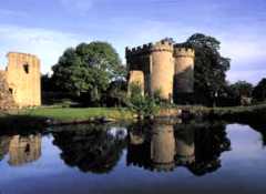 |
Castle
Street Whittington Oswestry Shropshire SY11 4DF From Shrewsbury take the A5 towaards Oswestry At the Mile end roundabout (Little chef) turn right following the A5 At the next roundabout turn right on to the A495 to Whittington Follow road over level crossing, at the next junction turn left to the castle Email:- c.robinson@btinternet.com WHITTINGTON CASTLE CLICK |
Tel: 01691 662397 |
| Wilderhope Manor Wilderthorpe Manor
stands on the slopes of Wenlock Edge offering fine
views of the unspoilt surrounding countryside. The National Trust has
owned the Elizabethan gabled manor house since 1971. It has a beautiful
interior that includes noteworthy features such as a remarkable wooden
spiral staircase and fine plastered ceilings. The grounds are a popular
place for walkers and ramblers.
|
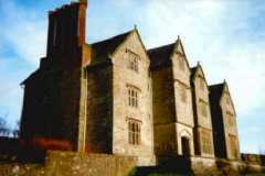 |
Longville, Much Wenlock, Shropshire TF13 6EG Map WILDERHOPE MANOR CLICK |
Phone: +44 (0)870 770 6090 |
The WrekinSeek the spiritual heart of Shropshire and you’ll find the Wrekin. The Wrekin plays an important role in Shropshire folk-lore. To us it represents home, and we love it.Visitors, pilgrims, honoured guests – we give you the Shropshire toast.The Wrekin is perhaps Shropshire’s best known landmark, a curious legendary hill that, from this way it looks like a mountain, and that way, it crouches low. From the top you can see fifteen counties. It was also the inspiration for Tolkien's Middle Earth in the acclaimed series of books - The Lord of The Rings. Tolkien used to live nearby and drew inspiration from the magnificent Shropshire landscape.It dominates the view of Telford and Ironbridge being 1335 ft tall and who would have guessed that Shropshire folk-lore tells us it was built by a giant who took a dislike to Shrewsbury.The Giant in question was a Welshman who dug a spadeful of soil and planned to dump it into the river severn, flooding the town. However, whilst slogging across the Shropshire hills, this giant lost his bearings and having only got as far as Wellington stopped for a rest. Sitting on the roadside he called out to a passing cobbler trying to find the direction to Shrewsbury. He told the cobbler he was going to flood the town.The cobbler, a quick thinking business man, thought for a moment and realized if the giant flooded Shrewsbury, he’d lose all his customers.The cobbler quickly emptied his sack of worn out shoes onto the roadside and told the giant that he’d worn these shoes out himself coming from Shrewsbury.The giant, thinking better of his plan then decided to forget about Shrewsbury and go home instead. The Giant dumped his spadeful of soil on the roadside, and then scraped his boots clean with his spade.The mound of earth became the Wrekin and the smaller hill where he scraped his boots became the Ercall |
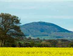 |
Telford,
Shrosphire |
|
Need Someone to Visit Mercia With?
|
|||
| Travbuddy.com | With over 43,000 members and over 185,000 "future travel" plans entered, Travbuddy is one of the largest services for finding a travel companion online. You can post your travel blog, photos and tips on the site too. For added peace of mind, the site also operates a system where members "vouch" for other members after meeting them in real life. They say there have been over 5,000 vouches so far and none have been negative. | ||
| Companions2travel.co.uk | Launched in 2004, this site now has over 18,000 members. Trial membership is free, while full membership costs £5 and entitles you to contact all other members directly. Your profile can be matched to others based on common interests, and you can also post suggestions for group trips on the forum. | ||
| Thelmandlouise.com | As the name implies, it's women only on thelmaandlouise.com. It's free to join and you can find someone that specifically matches your criteria through the advanced-search function. Want a spa-loving, 40-year-old who adores rock music and enjoys an occasional drink? You got it. | ||
| Meetup.com | Prefer group travel? Meetup.com lists worldwide get-togethers for specialist interests. "A little less face-to-screen and a little more face-to-face" is its tagline. Search for "travel" against your hometown and see what shows up. Edinburgh, for example, has two groups for lovers of adventurous pursuits, including Scottish Intrepid Adventurers which has organised over 300 meets and trips. | ||
| fishingforafriend.com |
Meet a companion for travels – gap year or ‘silver’ gap year, a cruise or going InterRail | ||
| buddies4travel.co.uk |
They
specialize in sourcing and matching female travel companions who wish
to travel with other women for trips and holidays in the UK and
overseas. |
||
| www.singleagain.co.uk |
Travel
Companions
is for people who are looking for someone to join them on
holiday - possibly just for companionship or perhaps also to avoid
paying the annoying Single Person Supplement. Travel
Companions has been running successfully since 1986 and has seen
members setting off together to all four corners of the world. It is
open to men and woman of all ages - in fact the youngest member is in
his 20s and the oldest is 80
|
||
Safety tips from companions2travel• Do not provide personal contact details or any other personal information until you have corresponded via the site a few times. • Phone the person before you meet. • Meet in a public place, possibly accompanied, and let someone else know where you are going and when you expect to be back. • Use your common sense and your intuition. If you do not feel comfortable about meeting in person when it comes to it, then follow your instincts - don't. • Consider meeting up as part of a group.
|
|||
|
prepared by Lance Publications,
Park
House, Park Road, Petersfield, Hampshire, GU32 3DL
The full Directory is
available
from them.This section is included in
memory
of the late Alec Davey of R.Bromley & Co. Ltd- the wine
merchants,
to commemorate his 25 years entertaining all at the major events
(1962-1987). Read about him CLICK HEREemail: info@showmans-directory.co.uk website: www.showmans-directory.co.uk |
 |
|
April May
June
July
August
September
November December |
Please
Click
On To the Relevant Stable door
|

Famous Mercians From Shropshire
Advertisements |
||||||||||||||
|
||||||||||||||
| www.merciatouristboard.org.uk
|
www.ukinformedinvestor.co.uk | www.wessextouristboard.org.uk |
| A
|
|
C
|